A new satellite image released by the European Space Agency shows how fast Dhaka has expanded in recent years. The Earth from Space Dhaka image compares the area around the city in February 2017 and February 2026.
The pictures were captured by the Copernicus Sentinel‑2 mission. They reveal large changes in land use around Bangladesh’s capital over the past nine years.
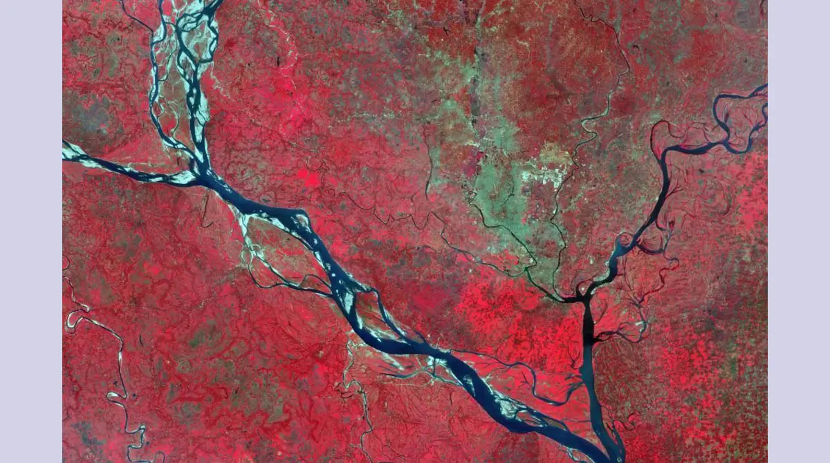
The satellite images were processed using near-infrared light. This method helps analysts separate natural features from built structures. Vegetation appears in red, water bodies appear dark blue or black, and urban areas appear grey.
In the 2026 image, grey areas around the city centre have spread outward. This shows the rapid growth of housing, roads, and commercial buildings. Many places that appeared bright red in 2017 now show duller colours, suggesting soil exposure, construction work, or paved surfaces.
Dhaka sits on a low floodplain crossed by several rivers. Three rivers run through the city from west to east: the Dhaleswari River, the Buriganga River, and the Sitalakhya River.
Larger rivers shape the wider region. The Padma River flows to the west, while the Jamuna River approaches from the northwest. The Meghna River runs along the eastern side before reaching the Bay of Bengal.
These rivers form one of the largest river systems in the world. The Jamuna is the lower course of the Brahmaputra River, which begins on the Tibetan Plateau and flows through India before entering Bangladesh. The Padma is the lower section of the Ganges River inside Bangladesh.
The land between these rivers sits only slightly above sea level. Seasonal monsoon rains bring heavy sediment and constant change to the floodplain. Some river channels widen or shift position over time.
The satellite comparison also shows changes in river shapes. Parts of the Padma River appear wider in 2026 than in the earlier image. Light patches along some channels reveal dry or exposed riverbeds during lower water levels.
Dhaka’s population growth is a key driver of these changes. The metropolitan area now holds more than 36 million people. This makes it the most populous city in Bangladesh and one of the fastest-growing urban regions in South Asia.
Urban growth at this scale creates pressure on farmland, wetlands, and natural resources around the city. It also increases demand for housing, transport, and water management.
Satellite monitoring helps planners understand these changes more clearly. Data from the Sentinel-2 mission allows researchers to track vegetation, water resources, and land development over time.
Such information can help urban planners and policymakers manage future development. Continuous satellite monitoring will also help track how Dhaka’s landscape continues to change in the coming years.
Source: www.esa.int